The network isn't written down
In most paratransit cities no one holds a list of routes, stops or terminals. Before anyone can plan, the network has to be found on the street.
Behind every overcrowded matatu and hand-painted route sign lies critical transit intelligence. Our platform captures this data with precision and speed, creating the GTFS feeds, datasets, and strategic insights that transform how cities move.
The problem
In most paratransit cities no one holds a list of routes, stops or terminals. Before anyone can plan, the network has to be found on the street.
Surveys started in the wrong place or at the wrong time, and records lost on the way back, surface weeks later in cleaning — too late to collect again.
Dozens of researchers coordinated over chat groups and spreadsheets: no one can see who is where, who is late, or what is left to collect.
What you can run
Each survey family has its own planning, field app and review — not a generic form with different labels.
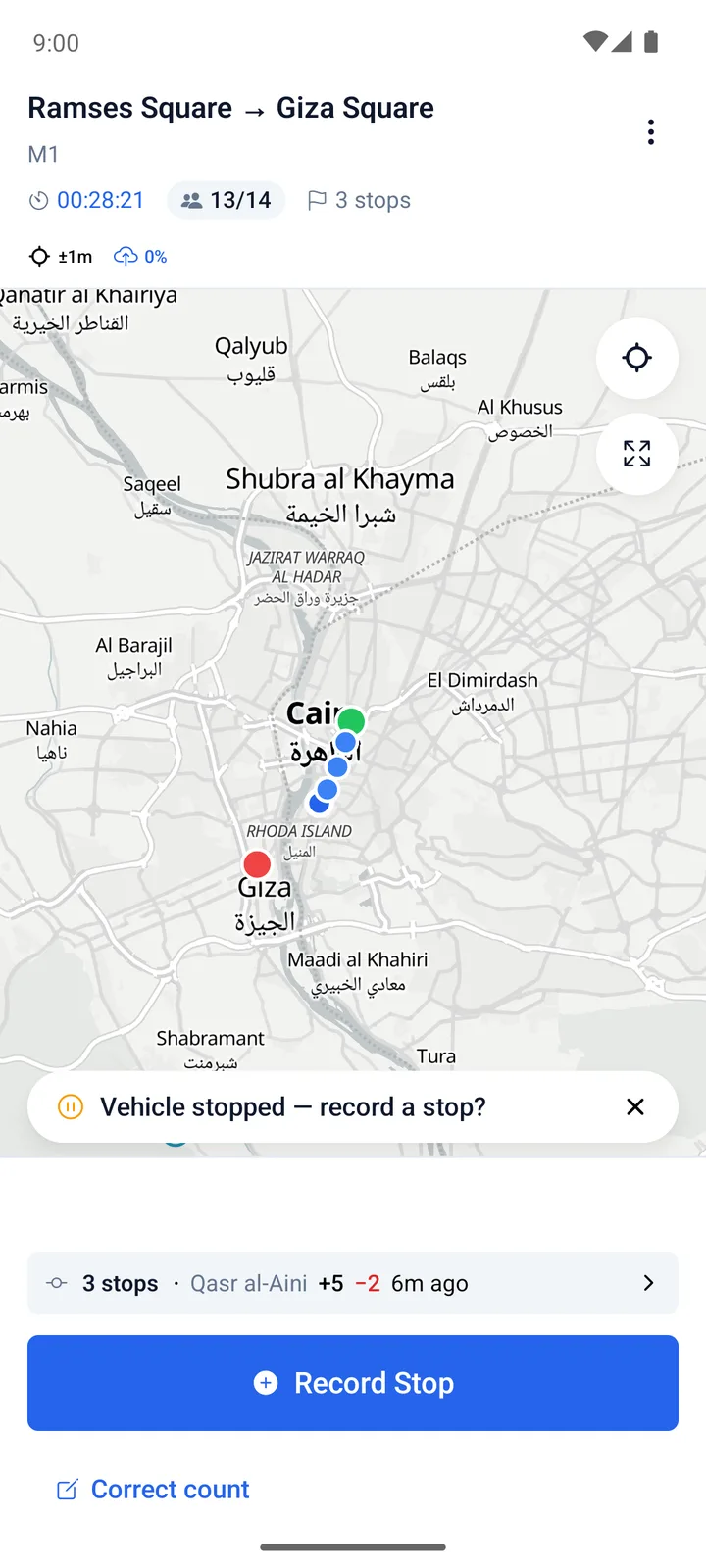
Find the routes, ride them end to end, and time their departures — to build a network model of a city's paratransit.
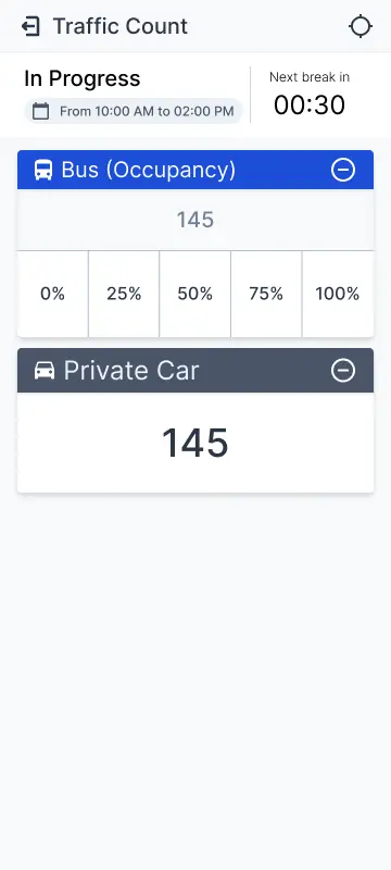
Classified vehicle counts at junctions and corridors where there are no cameras, planned and staffed post by post.
Questionnaire campaigns in geofenced zones, with quotas.
How a programme runs
Five stages, each with the screens that do the work.
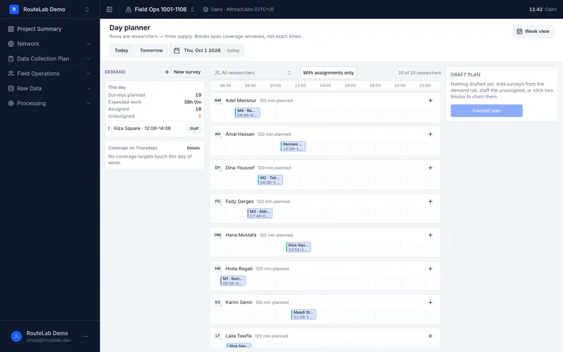
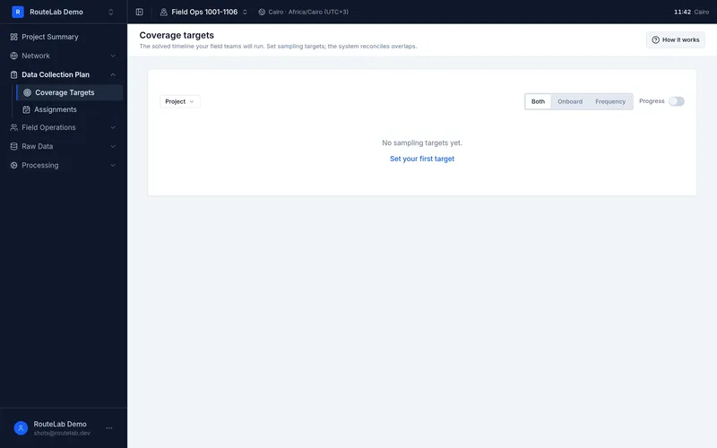
Coverage targets by route and time, and a dispatch planner that flags overloaded days and impossible orders before anyone leaves.
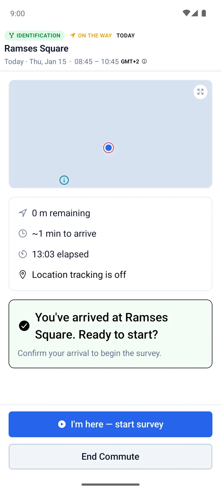
Observer, the field app: guided surveys that start only at the right place and time, and keep every record offline.
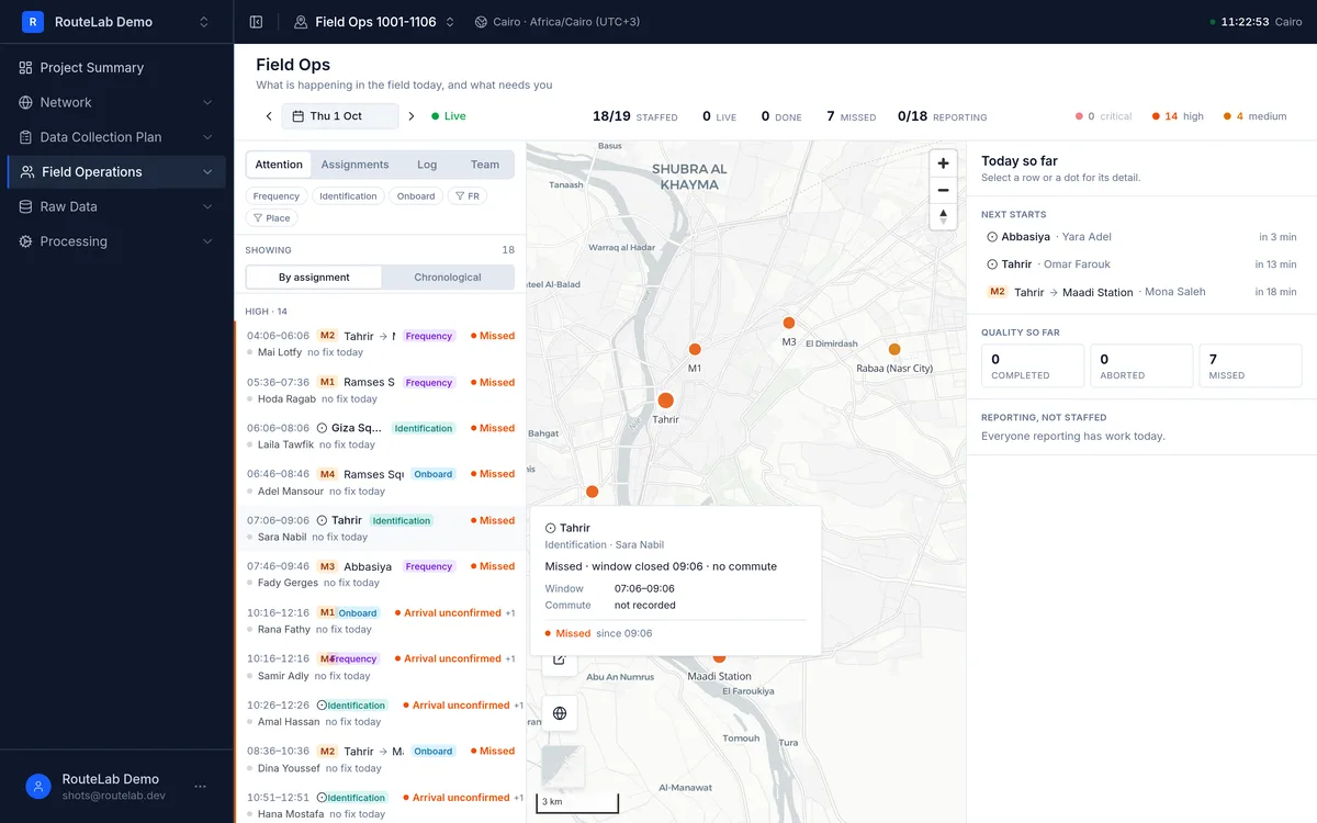
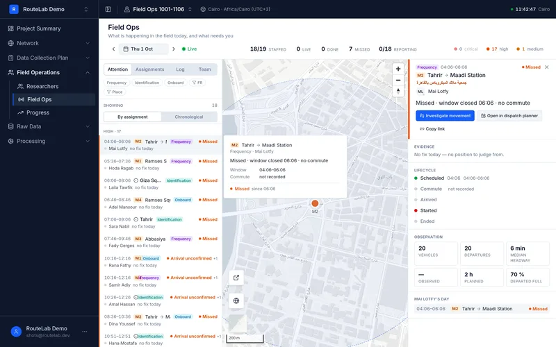
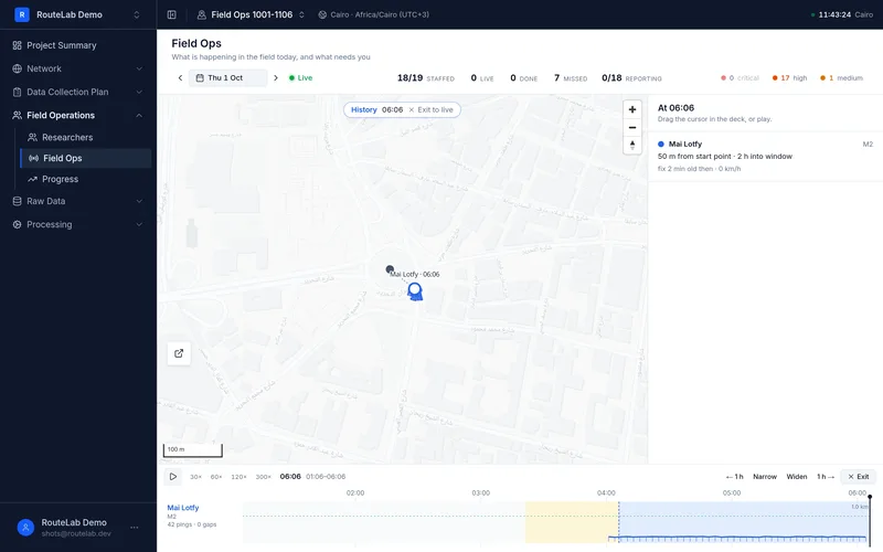
Field Ops shows every researcher on a live map, and who is late, at risk or missing — while it can still be fixed.
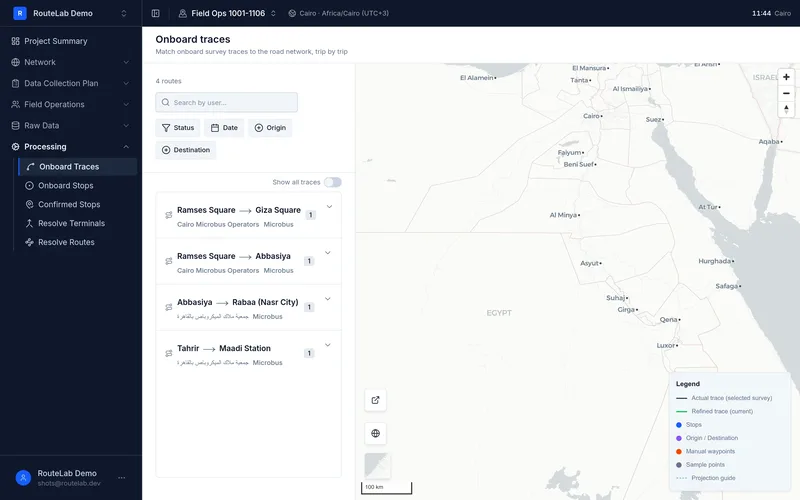
Every onboard trip is reviewed — its trace, its stops — and accepted or rejected before it reaches you.
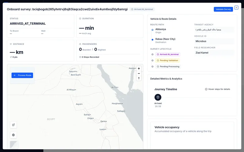
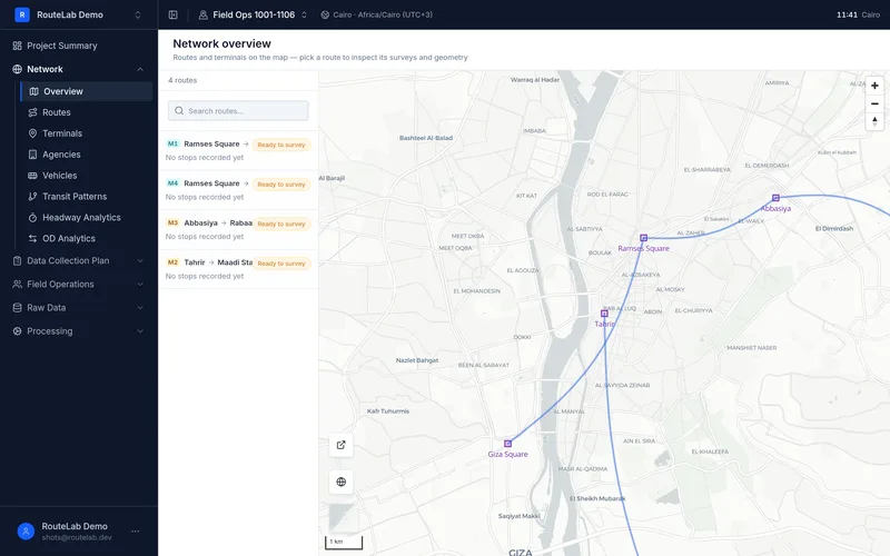
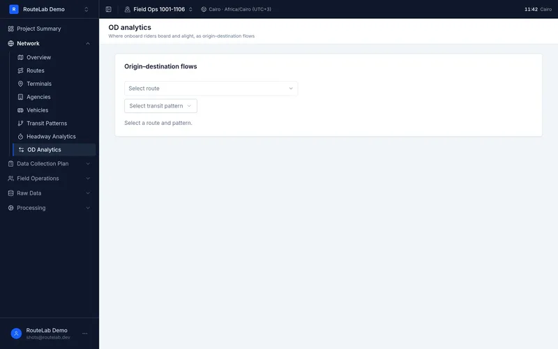
A network model of routes, terminals and stops, with headways from frequency surveys and origin–destination flows from onboard surveys.
Coverage targets by route and time, and a dispatch planner that flags overloaded days and impossible orders before anyone leaves.
Observer, the field app: guided surveys that start only at the right place and time, and keep every record offline.
Field Ops shows every researcher on a live map, and who is late, at risk or missing — while it can still be fixed.
Every onboard trip is reviewed — its trace, its stops — and accepted or rejected before it reaches you.
A network model of routes, terminals and stops, with headways from frequency surveys and origin–destination flows from onboard surveys.
Observer, the field app
At the right place
A survey starts at its terminal — or not at all.
At the right time
Every observation carries a time you can rely on.
Nothing lost
Built for places with no signal.
Every record accountable
Know who recorded what — and review it.
Built and used by
RouteLab is the system Transport for Cairo built and uses to run its own surveys — supported by the engineers who build it.
Start in the app, or tell us about your project and we'll walk you through it.